
Aluminium Plant Mapping Storm-Water Drain Integrity Across the
| Endobot
Chhattisgarh
PROJECT OVERVIEW
An aluminium plant in Chhattisgarh required structural and functional condition assessment of its stormwater drains. The project focused on identifying blockage levels, structural integrity, missing access points and usability of critical drain sections across around 34 km of stormwater network.
PROJECT OVERVIEW
An aluminium plant in Chhattisgarh required structural and functional condition assessment of its stormwater drains. The project focused on identifying blockage levels, structural integrity, missing access points and usability of critical drain sections across around 34 km of stormwater network.
TECHNOLOGY USED
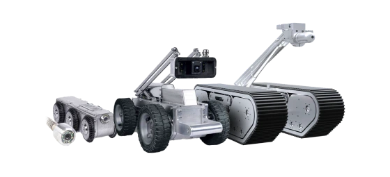
Endo 250 for internal drain inspection BTP (Build-to-Purpose systems) for drain assessment Raft-based inspection platforms for water-filled sections DGPS mapping for precise location reference tracking
PROJECT EXECUTION
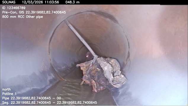
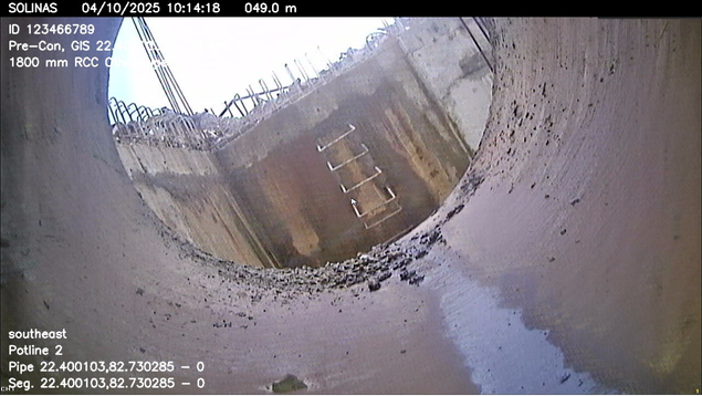
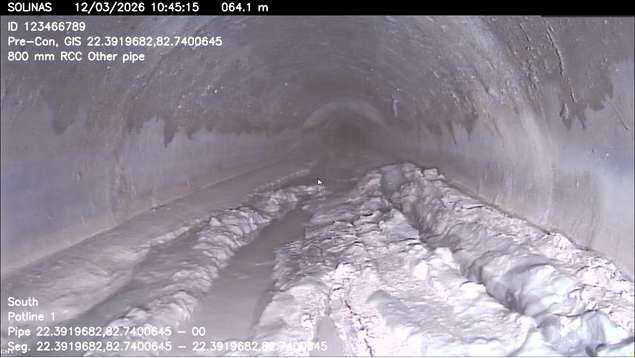
The plant’s drainage network included accessible, difficult-to-access, water-filled and flood-affected sections spread across the aluminium facility. Several stretches had suspected heavy blockage, structural compromise, missing manholes, poor usability or had been covered by floodwater and lost from active use. Conventional visual checks were not sufficient to confirm the continuity and internal condition of these drains. Solinas deployed Endo 250, BTP, raft-based inspection and DGPS tracking to inspect open, closed and water-filled storm-water drain sections. The team captured internal visuals, mapped inspected locations and linked findings to accurate field references. This approach helped identify blockage-prone zones, structurally weak areas, missing access points, inactive drain sections and untraceable stretches that required cleaning, rehabilitation or restoration.
FINDINGS & IMPACT
The assessment showed that 40.74% of the inspected network was in good condition, 50.98% required planned maintenance and 8.25% needed immediate intervention. Key issues included sludge, silt, stones, foreign materials, vegetation growth, sidewall damage, collapsed walls and severe/partial blockages. The report also highlighted inaccessible stretches, unknown manholes and priority zones for targeted maintenance.
34 KM
stormwater drain network inspected
7 KM
inaccessible network identified 2 unknown manholes identified
PROJECT BENEFITS
Condition-Based Prioritisation: Classified drains into good, non-satisfactory and immediate-action categories. Flood & Disruption Risk Reduction: Identified critical blockage and structural-risk zones. Improved Asset Visibility: Mapped open/underground drains, manholes and inaccessible stretches. Maintenance Planning Roadmap: Enabled targeted desilting, debris removal, repairs and routine inspection.